Grid reference NG8344
near to Tornapress, Highland, Scotland
Coverage
We have
8 images
in grid square NG8344
Contribute
Explore gridsquare NG8344
Surrounding area
Maps
 Map © Crown Copyright")
TIP: Click the map for more Large scale mapping
Tip: Click the map to open the coverage map
We have
8 images
for NG8344
|
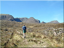
Looking to A Chioch from the path to Loch Gaineamhach
Taken 29th April 2007.
|
|
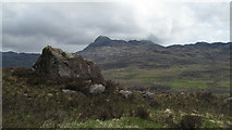
Sandstone Boulder Beside Stalkers' Path
A fine stalkers' path passes this boulder en route for Loch Gaineamhach. The mountain in the distance is Sgurr a' Gharaidh.
|
|
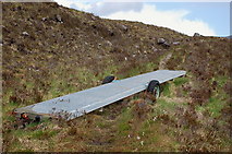
A bridge on wheels?
by Jim Barton
A length of metal gangway lashed onto a small trailer, unaccountably abandoned on the path up to Loch Gaineamhach.
|
|
Small dam above Couldoran
by Gordon Brown
Apparently for a small hydro-electric power scheme.
|
|
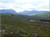
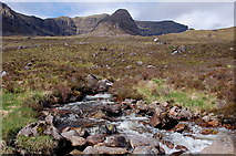
Coire na Feola
by Jim Barton
The second of six corries on the E side of Beinn Bhan rising above the moorland, seen from the path to Loch Gaineamhach.
|
|
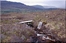
Footbridge below Coire na Feola, Beinn Bhan
by Jim Barton
The bridge spans the burn draining this corrie, though the next burn from Coire na Poite is much larger but unbridged.
|
|
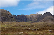
Allt Coire na Poite, Beinn Bhan
by Jim Barton
A vigorous fast-flowing burn which drains from the lochans in Coire na Poite (the right-hand corrie). Coire na Feola is to the left, bounded by the ridge of A' Chioch in the centre.
|
|
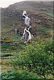
Waterfalls near the River Kishorn
by Malcolm Neal
Tumbling down from the hills there was no shortage of water to feed the falls as it rained every day at some time during our stay here 25 years ago.
|
|