Grid reference ND3444
near to Thrumster, Highland, Scotland
Coverage
We have
10 images
in grid square ND3444
Contribute
Explore gridsquare ND3444
Surrounding area
Maps
 Map © Crown Copyright")
TIP: Click the map for more Large scale mapping
Tip: Click the map to open the coverage map
We have
10 images
for ND3444
|
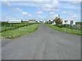
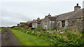
Entry to Sarclet
by Stanley Howe
|
|
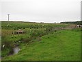
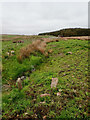
Burn, Corbiegoe
by Richard Webb
A burn which drains a large area of bog land near Thrumster.
|
|
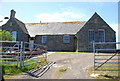
Former School
by Glen Breaden
Thrumster now has a new school just along the road.
|
|
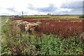
Weedy field and old bales, Corbiegoe
by Alan Reid
|
|
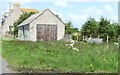
House and garage
by Stanley Howe
Between Sarclet and Thrumster.
|
|
Road, Oldhall
by Richard Webb
Minor road serving Corbiegoe. The combine shows that some of the land here is arable. Inland the ground becomes more peaty.
|
|
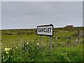
Sarclet Sign
Highland Council sign for Sarclet.
|
|
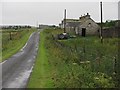
Abandoned cottage, Oldhall
by Mick Garratt
|
|
Ditch, Oldhall
by Mick Garratt
|
|
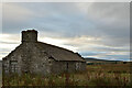
Ruined Croft Building near Thrumster, Caithness
by Andrew Tryon
|
|