Grid reference SE3324
near to Lofthouse Gate, Wakefield, England
Coverage
We have
118 images
in grid square SE3324
Contribute
Explore gridsquare SE3324
Surrounding area
Maps
 Map © Crown Copyright")
TIP: Click the map for more Large scale mapping
Tip: Click the map to open the coverage map
Sample images
Breakdown list
images taken from SE3324 [2]
A sample of 12 photos from 118
for SE3324
- View this square in the Browser >>>
|
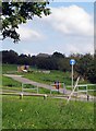
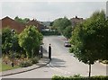
Naggers park entrance.
by Mike Kirby
Access to the park can be gained from Baker Lane.
|
|
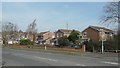
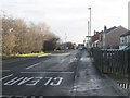
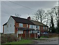
Houses on Broadmeadows, near Stanley Lane Ends
Despite the street name, this area was full of coal pits and mineral lines by 1850.
|
|
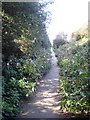
Rhodes Gardens - Lingwell Nook Lane |
|
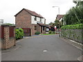
Canal Lane, Lofthouse Gate
by Chris Heaton
|
|
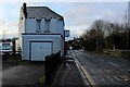
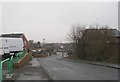
Park View, Lofthouse Gate
Looking towards the A61.
|
|
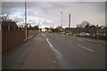
Edward Drive - Leeds Road |
|
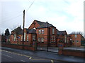
Lofthouse Gate School
by JThomas
|
|
Canal Lane - Leeds Road |
|
Potovens Lane |
|
Stanley, 134 Rooks Nest Road
by Mel Towler
According to the OS benchmark database there is a benchmark cut into the north-east facing gable end of the property. The fence obscures any view of the area.
|
|
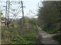
Old tram road
by Mike Kirby
The old tram road, the Naggers, viewed from the Rooks Nest end, to show the steep incline.(Great coming down on your bike).
|
|
The Naggers Line, near Meadowcroft Road
Former tramway built in the 1840s to carry coal from collieries at Lofthouse Gate to the Aire & Calder Navigation's canal basin at Stanley Ferry. Used until the 1920s and now a popular path.
|
Explore more images in this square: | View Filtering options | View all 118 images page by page >>> |
|