2008
SO9097 : Lea Road, Penn Fields, Wolverhampton
taken 15 years ago, near to Blakenhall, Wolverhampton, England
This is 1 of 3 images, with title Lea Road, Penn Fields, Wolverhampton in this square
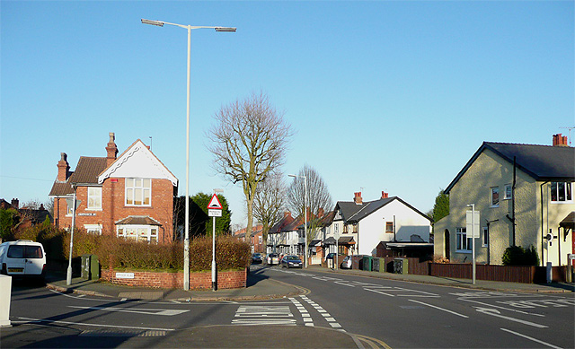
Lea Road, Penn Fields, Wolverhampton
This is the junction with Jeffcock Road (left), which goes north-north-west towards Merridale. The housing is mainly early 20th century, a mixture of terraced and semi-detached buildings. The population in the area is multi-cultural, and Lea Road still has many corner shops and other small family run shops on its way to joining the Penn Road near the Wolverhampton Ring Road.
 Map © Crown Copyright")
TIP: Click the map for more Large scale mapping
- Grid Square
- SO9097, 372 images (more nearby 🔍)
- Photographer
- Roger D Kidd (more nearby)
- Date Taken
- Friday, 26 December, 2008 (more nearby)
- Submitted
- Saturday, 27 December, 2008
- Subject Location
-
OSGB36:
 SO 902 971 [100m precision]
WGS84: 52:34.3411N 2:8.6999W - Camera Location
-
OSGB36: SO 902 971
- View Direction
- North-northeast (about 22 degrees)