2009
NT2871 : Peffer Street and Peffer Place
taken 15 years ago, near to Craigmillar, Edinburgh, Scotland
This is 1 of 5 images, with title starting with Peffer in this square
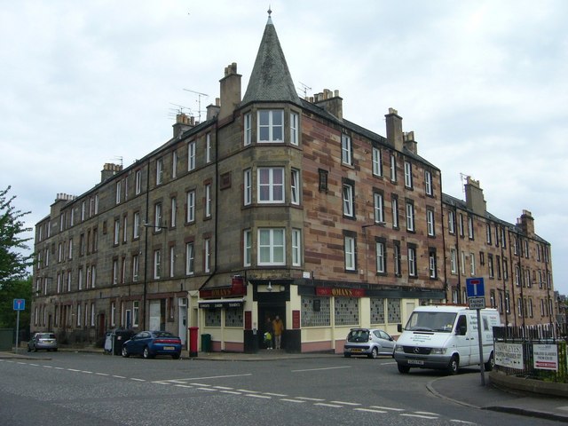
Peffer Street and Peffer Place
Originally Station Road, Peffer Street, built in the 1880s, provided access to Duddingston & Craigmillar railway station. It was renamed, after nearby Peffermill, in 1967. The adjacent Peffer Place, built in the following decade, was originally Mitchell Street. They were the only Victorian tenement blocks built in the brewery suburb of Craigmillar.
 Map © Crown Copyright")
TIP: Click the map for more Large scale mapping
- Grid Square
- NT2871, 214 images (more nearby 🔍)
- Photographer
- kim traynor (more nearby)
- Date Taken
- Wednesday, 3 June, 2009 (more nearby)
- Submitted
- Friday, 5 June, 2009
- Subject Location
-
OSGB36:
 NT 287 719 [100m precision]
WGS84: 55:56.0916N 3:8.5049W - Camera Location
-
OSGB36: NT 287 718
- View Direction
- North-northeast (about 22 degrees)