2009
SZ5677 : Saint Boniface Road, Ventnor
taken 15 years ago, near to Ventnor, Isle of Wight, England
Saint Boniface Road, Ventnor
I'm not, generally, a fan of the ultra wide angle lens. However; for this picture, it was very useful.
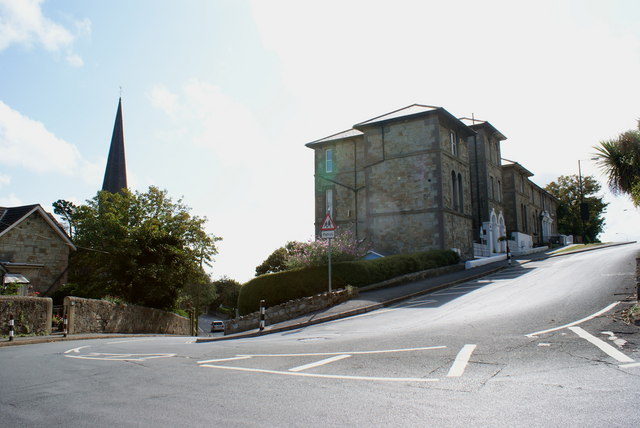
Trinity Road comes out of Ventnor, from the direction of the church, and joins Saint Boniface Road at this point. Saint Boniface Road runs from the left (out of picture) up the hill to the right. Both the bend, and gradient, are as sharp as they appear.
Trinity Road comes out of Ventnor, from the direction of the church, and joins Saint Boniface Road at this point. Saint Boniface Road runs from the left (out of picture) up the hill to the right. Both the bend, and gradient, are as sharp as they appear.
 Map © Crown Copyright")
TIP: Click the map for more Large scale mapping
- Grid Square
- SZ5677, 647 images (more nearby 🔍)
- Photographer
- Peter Trimming (more nearby)
- Date Taken
- Tuesday, 25 August, 2009 (more nearby)
- Submitted
- Tuesday, 25 August, 2009
- Subject Location
-
OSGB36:
 SZ 568 779 [100m precision]
WGS84: 50:35.8890N 1:11.8531W - Camera Location
-
OSGB36: SZ 569 779
- View Direction
- South-southwest (about 202 degrees)