2010
SJ9483 : Bridge at Higher Poynton
taken 14 years ago, near to Higher Poynton, Cheshire East, England
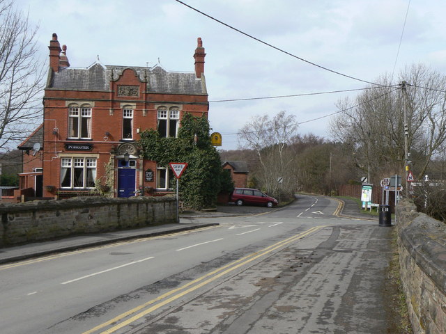
Bridge at Higher Poynton
For a minor road, the footway at the right hand side of the bridge seems excessive. The reason is that this is the line of the tramroad from the Anson Colliery (which was behind the distant trees) to the Macclesfield Canal. To the left is The Boar's Head; this was a replacement for an earlier building, still in existence today, to the right of the picture.
Poynton Collieries
Poynton was the centre of a small but thriving coal-mining industry which developed towards the end of the 18th century, flourished during the second half of the 19th century, and lasted, with a small number of relatively modern pits until the mid 1930s.
A comprehensive study of the history of the Poynton Collieries can be found here: Link
Link
Link
Link
Link
 Map © Crown Copyright")
TIP: Click the map for more Large scale mapping
- Grid Square
- SJ9483, 201 images (more nearby 🔍)
- Photographer
- Alan Murray-Rust (more nearby)
- Date Taken
- Thursday, 25 March, 2010 (more nearby)
- Submitted
- Tuesday, 30 March, 2010
- Subject Location
-
OSGB36:
 SJ 9442 8336 [10m precision]
WGS84: 53:20.8261N 2:5.1168W - Camera Location
-
OSGB36: SJ 9444 8334
- View Direction
- Northwest (about 315 degrees)