2010
SJ9483 : Middlewood Way
taken 14 years ago, near to Higher Poynton, Cheshire East, England
This is 1 of 2 images, with title Middlewood Way in this square
Middlewood Way
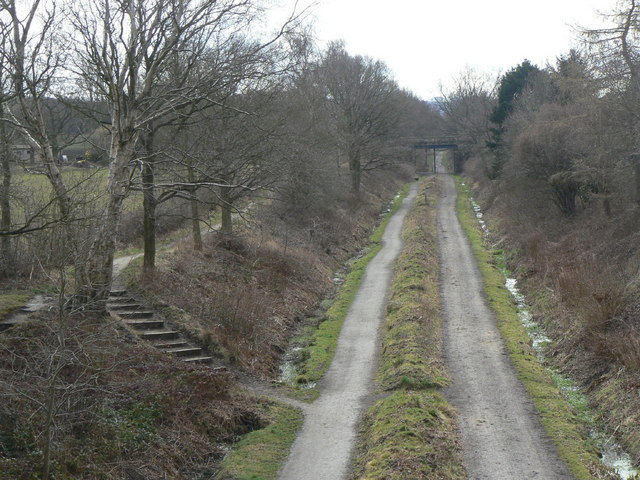
Looking south from Prince Road bridge. The Way is split into all-user (right) and pedestrian-only (left) paths. When created, trees were planted in the median strip but these were found to create a very dark atmosphere, as well as significantly adding to maintenance costs of the pathways, so they have recently been removed.
 Map © Crown Copyright")
TIP: Click the map for more Large scale mapping
- Grid Square
- SJ9483, 201 images (more nearby 🔍)
- Photographer
- Alan Murray-Rust (more nearby)
- Date Taken
- Thursday, 25 March, 2010 (more nearby)
- Submitted
- Tuesday, 30 March, 2010
- Subject Location
-
OSGB36:
 SJ 944 839 [100m precision]
WGS84: 53:21.1552N 2:5.0544W - Camera Location
-
OSGB36: SJ 944 840
- View Direction
- SOUTH (about 180 degrees)