2007
SD6697 : Summit area of The Calf
taken 17 years ago, 3 km from Wardses, Cumbria, England
This is 1 of 2 images, with title Summit area of The Calf in this square
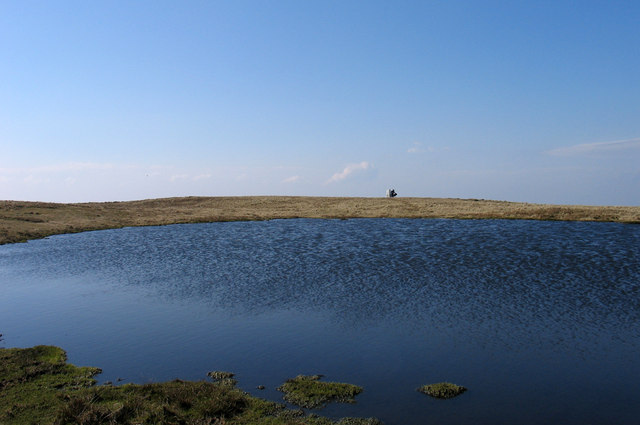
Summit area of The Calf
Few mountain summits can have a tarn particularly one as sizeable as this so close to their highest point; that point is marked by the OS trig point, seen on the horizon.
 Map © Crown Copyright")
TIP: Click the map for more Large scale mapping
- Grid Square
- SD6697, 38 images (more nearby 🔍)
- Photographer
- Trevor Littlewood (more nearby)
- Date Taken
- Monday, 26 March, 2007 (more nearby)
- Submitted
- Monday, 7 May, 2012
- Subject Location
-
OSGB36:
 SD 6678 9707 [10m precision]
WGS84: 54:22.0832N 2:30.7683W - Camera Location
-
OSGB36: SD 6680 9707
- View Direction
- West-southwest (about 247 degrees)