2014
SO8173 : Path to Kingsway, Stourport-on-Severn
taken 10 years ago, near to Wilden, Worcestershire, England
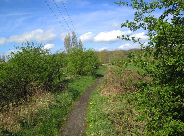
Path to Kingsway, Stourport-on-Severn
The path, which has reached here from the end of Zortech Avenue, Kidderminster, runs between land used by Burlish Park Golf Course on both sides. The path comes out on the road known as Kingsway on the fringe of Stourport-on-Severn.
 Map © Crown Copyright")
TIP: Click the map for more Large scale mapping
- Grid Square
- SO8173, 73 images (more nearby 🔍)
- Photographer
- P L Chadwick (more nearby)
- Date Taken
- Friday, 11 April, 2014 (more nearby)
- Submitted
- Saturday, 12 April, 2014
- Subject Location
-
OSGB36:
 SO 811 731 [100m precision]
WGS84: 52:21.3865N 2:16.7272W - Camera Location
-
OSGB36: SO 811 731
- View Direction
- West-northwest (about 292 degrees)