TQ2240 : Welland Gill, Mountnoddy Wood
taken 9 years ago, near to Charlwood, Surrey, England
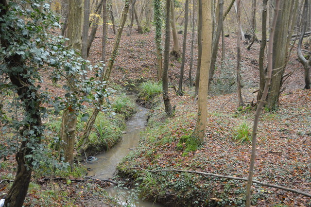
Welland gill is a short (approx. 6km) tributary of the River Mole, near the Surrey - West Sussex Boundary.
It is Welland Gill in its upper course, Dolby Brook later and eventually Man's Brook.
Glover's Wood is a Site of Special Scientific Interest located just outside Charlwood in Surrey. It is a broadleaved woodland with sections of ancient hornbeam coppice and oak. It is dissected by the deeply incised Welland Gill, a small tributary of the River Mole.
At 74 acres, Glover's Wood is one of the largest areas of woodland in the Surrey Weald, containing oak, hazel and birch trees. It is home to a variety of rare plants and wildlife, and features historical relicts including a medieval bank and ditch systems. The southern part is called Mountnoddy Wood.
 Map © Crown Copyright")
- Grid Square
- TQ2240, 124 images (more nearby 🔍)
- Photographer
- N Chadwick (more nearby)
- Date Taken
- Sunday, 30 November, 2014 (more nearby)
- Submitted
- Wednesday, 4 February, 2015
- Subject Location
-
OSGB36:
 TQ 2229 4007 [10m precision]
WGS84: 51:8.8103N 0:15.1843W - Camera Location
-
OSGB36: TQ 2227 4005
- View Direction
- Northeast (about 45 degrees)