2011
TQ2649 : Footpath off Crakell Road
taken 13 years ago, near to Reigate, Surrey, England
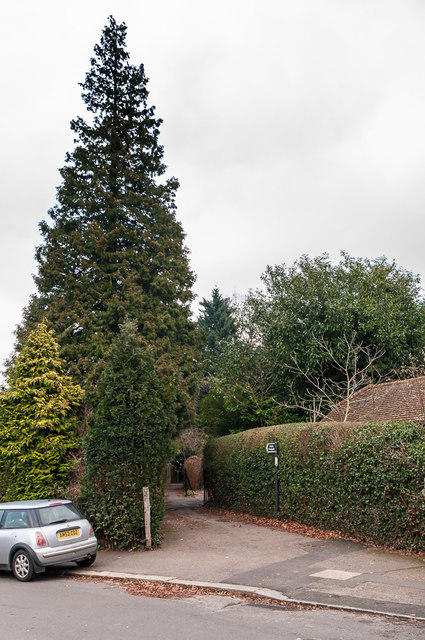
Footpath off Crakell Road
Footpath off Crakell Road running between the ends of the gardens in Blanford Road and Waterlow Road. This is a part of an old route, now part footpath and part residential road, linking Cockshot Hill and Shaws Corner - see TQ2549 : Smoke Lane for the start of it.
 Map © Crown Copyright")
TIP: Click the map for more Large scale mapping
- Grid Square
- TQ2649, 188 images (more nearby 🔍)
- Photographer
- Ian Capper (more nearby)
- Date Taken
- Saturday, 29 January, 2011 (more nearby)
- Submitted
- Friday, 10 February, 2017
- Subject Location
-
OSGB36:
 TQ 262 497 [100m precision]
WGS84: 51:13.9759N 0:11.5450W - Camera Location
-
OSGB36: TQ 262 497
- View Direction
- East-northeast (about 67 degrees)