2017
TQ3701 : Undercliff Walk, Saltdean
taken 7 years ago, near to Rottingdean, Brighton And Hove, England
This is 1 of 3 images, with title Undercliff Walk, Saltdean in this square
Undercliff Walk, Saltdean
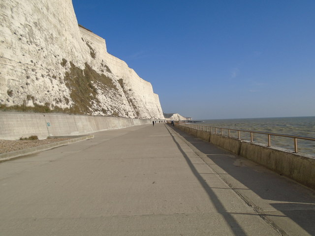
In 1928, Rottingdean parish was absorbed by Brighton and in order to protect the coastline an impressive sea wall at the base of the cliffs was erected, initially from Black Rock (the former boundary of Brighton parish) to Rottingdean.
The Undercliff Walk, as it became known, was designed by borough engineer David Edwards and opened in July 1933. It was extended to Saltdean Gap in July 1935 when the Rottingdean swimming-pool was built to replace bathing facilities lost to the wall.
A final short addition to the wall taking it to the very end of the borough boundary was made later in 1935. The Undercliff Walk is now 3.35 miles long and forms part of a 7.5 mile promenade from Portslade to Saltdean. Link
See other images of Undercliff walk - Brighton
 Map © Crown Copyright")
TIP: Click the map for more Large scale mapping
- Grid Square
- TQ3701, 52 images (more nearby 🔍)
- Photographer
- Paul Gillett (more nearby)
- Date Taken
- Monday, 13 February, 2017 (more nearby)
- Submitted
- Monday, 13 February, 2017
- Subject Location
-
OSGB36:
 TQ 37652 01983 [1m precision]
WGS84: 50:48.0639N 0:2.8791W - Camera Location
-
OSGB36: TQ 37553 02005
- View Direction
- East-southeast (about 112 degrees)