2007
SE2123 : Site of Gas-holder, Wormald Street, Mill Bridge, Liversedge
taken 17 years ago, near to Heckmondwike, Kirklees, England
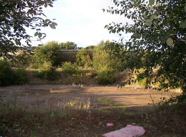
Site of Gas-holder, Wormald Street, Mill Bridge, Liversedge
The gas-holder is still shown on the latest 1:25000 map, but there is just a hole in the ground where it was. There was another to the south of the footpath from which this photograph was taken, but the site has been redeveloped.
 Map © Crown Copyright")
TIP: Click the map for more Large scale mapping
- Grid Square
- SE2123, 647 images (more nearby 🔍)
- Photographer
- Humphrey Bolton (more nearby)
- Date Taken
- Monday, 10 September, 2007 (more nearby)
- Submitted
- Monday, 10 September, 2007
- Subject Location
-
OSGB36:
 SE 210 235 [100m precision]
WGS84: 53:42.4505N 1:41.0006W - Camera Location
-
OSGB36: SE 210 234
- View Direction
- NORTH (about 0 degrees)