2018
NY0337 : Ordnance Survey Cut Mark
taken 6 years ago, near to Maryport, Cumbria, England
This is 1 of 3 images, with title Ordnance Survey Cut Mark in this square
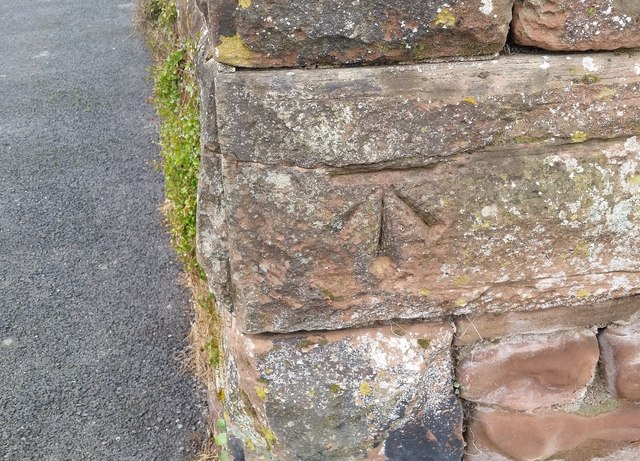
Ordnance Survey Cut Mark
This OS cut mark can be found on the wall NW side of Camp Road. It marks a point 49.091m above mean sea level.
 Map © Crown Copyright")
TIP: Click the map for more Large scale mapping
- Grid Square
- NY0337, 52 images (more nearby 🔍)
- Photographer
- Adrian Dust (more nearby)
- Date Taken
- Tuesday, 27 March, 2018 (more nearby)
- Submitted
- Saturday, 31 March, 2018
- Subject Location
-
OSGB36:
 NY 0389 3710 [10m precision]
WGS84: 54:43.1809N 3:29.6163W - Camera Location
-
OSGB36: NY 0389 3710
- View Direction
- Northwest (about 315 degrees)