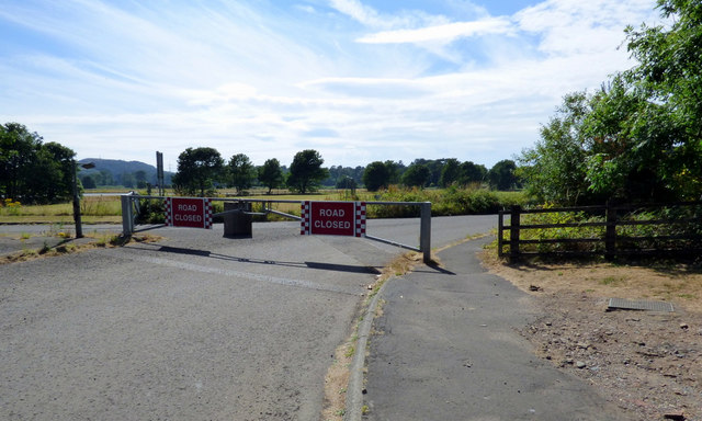
NS2052 : Power Station Road
taken 6 years ago, 3 km from Fairlie, North Ayrshire, Scotland

There are two roads which lead from the A78 Hunterston Road to the former oil rig construction yard and the nuclear power stations. The layout of these roads is a little confusing - I will try to explain why here.
As the name suggests, Power Station Road was built to serve the power stations at the south side of the Hunterston complex. Also as the name suggests, Oilrig Road was built to serve the oil rig construction yard, which is to the north of the power stations. All very straightforward, does what it says on the tin.
However, Power station Road leaves the roundabout north of Oilrig Road. The land is flat, which means that the roads need to cross each other in order to reach their respective destinations. Why? I don't know the answer to that and would love to know.
To add to the confusion, since the closure of the oil rig construction yard, all traffic for the power stations now uses the eastern section of Oilrig Road from the A78 to the crossroads with Power Station Road, where it joins that road for the final stretch to the power stations.
Power Station Road is closed by gates at the A78. The crossroads of the roads is controlled by a large 'kissing gate' which is almost permanently aligned to suit traffic to the power station.
