2021
TQ2649 : 17 and 13 Furzefield Road
taken 3 years ago, near to Reigate, Surrey, England
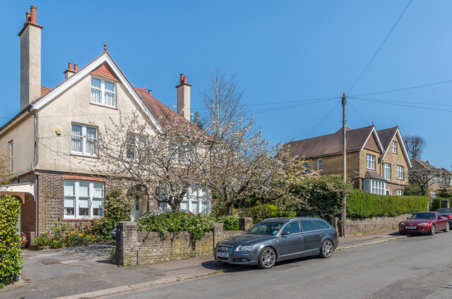
17 and 13 Furzefield Road
A road first developed in the early 20th Century, mainly on the northern side, with only a couple of houses on the southern side initially but with further additions over the years. Maps suggest that these two, now nos.17 (nearest) and 13 but marked as nos.1 and 3 respectively on the 1961-2 1:1,250 map, were among the earliest, with no 13 being one of the initial two buildings and no 17 following in the c.1920s.
 Map © Crown Copyright")
TIP: Click the map for more Large scale mapping
- Grid Square
- TQ2649, 188 images (more nearby 🔍)
- Photographer
- Ian Capper (more nearby)
- Date Taken
- Monday, 19 April, 2021 (more nearby)
- Submitted
- Thursday, 26 August, 2021
- Subject Location
-
OSGB36:
 TQ 262 494 [100m precision]
WGS84: 51:13.8357N 0:11.6201W - Camera Location
-
OSGB36: TQ 262 494
- View Direction
- Northeast (about 45 degrees)